MSFS MAP NG
Modern EFB app for msfs2020/2024
With high refresh rate,terrain radar display,charts,airport search,and more.


With high refresh rate,terrain radar display,charts,airport search,and more.
msfs map ng’s advanced electronic flight bag technology provides you with an affordable, all-in-one solution that makes flying easier, safer, and more enjoyable..

Keep track of your flight progress across all your devices.

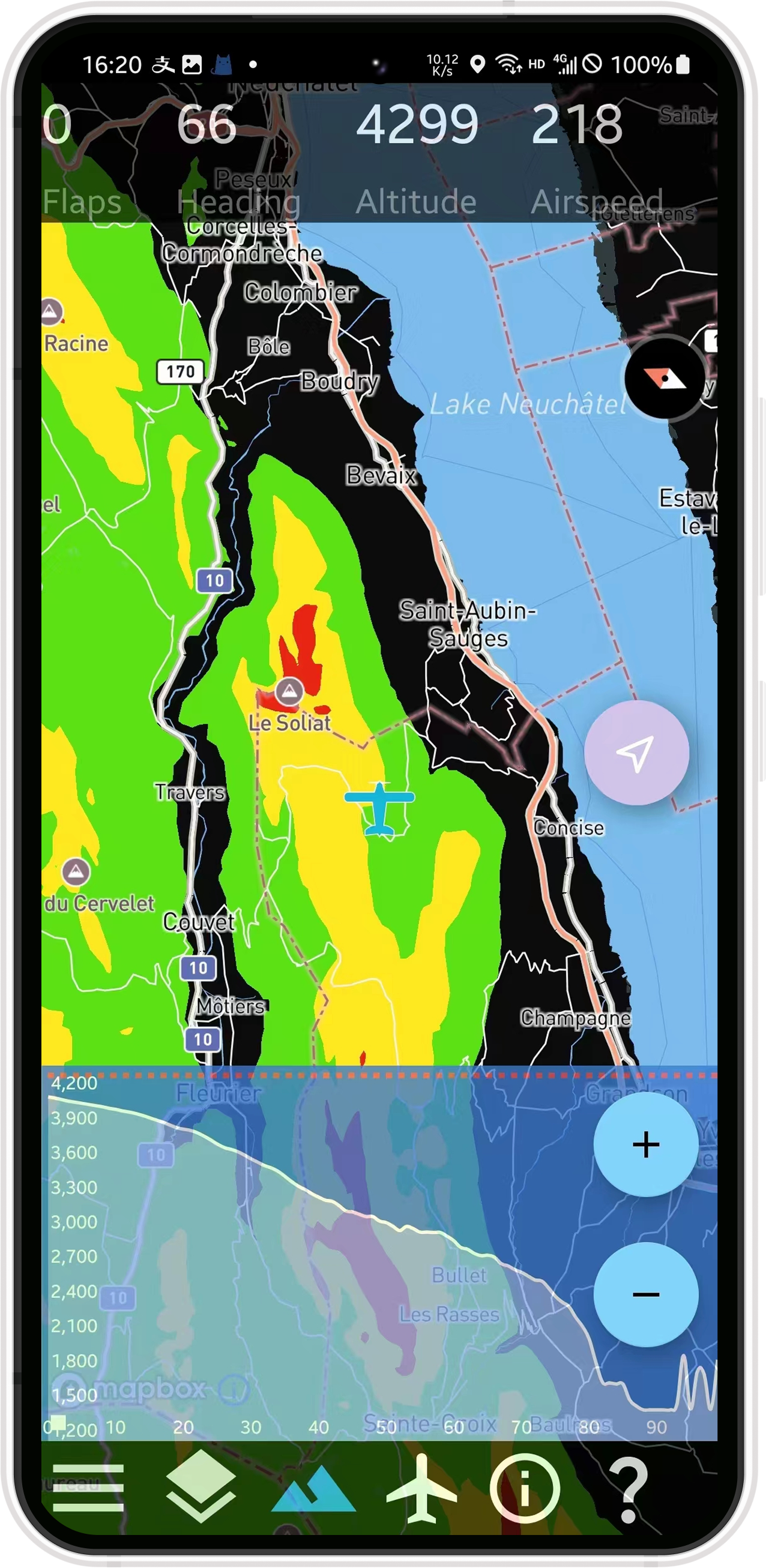
Different altitudes are displayed in different colors, and the colors change dynamically during your flight..

Display real-time precipitation conditions.

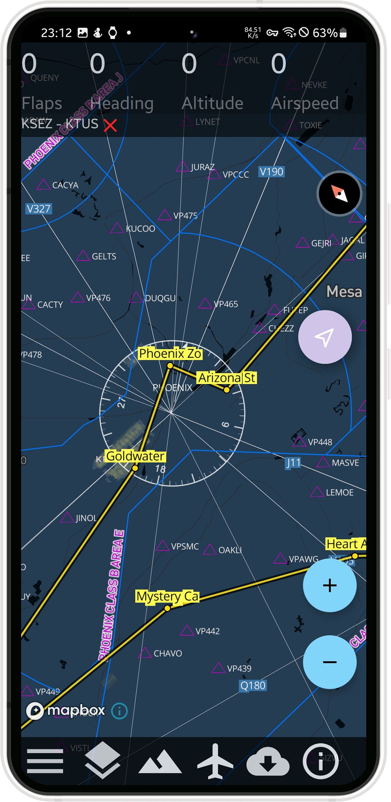
Over 65000 charts cover 2400 aiports around the world and is up to date

Displays a height chart of the terrain in front of the aircraft, which is particularly useful when flying in complex terrain and weather

airport search and infomation of airports,TAF,runway
MSFS MAP NG support 60Hz-120Hz high frame animation.With updated chars of airports all around the world
Happy Users
IOS Users
Android Users
Downlode Users
Temporibus autem quibusdam officiis debitis necessitatibus eveniet voluptates repudiandae molestiae non recusandae taque earum rerum hic asperiores repellat.
65000+ charts
No advertisement
Elevation profile
FAA sectional charts
Aviation layer
Temporibus autem quibusdam officiis debitis necessitatibus eveniet voluptates repudiandae molestiae non recusandae taque earum rerum hic asperiores repellat.

A server file is required to setup on your computer.You can download it from this webpage.
Check your firewall configuration,please open port 7788.
Praesent blandit gravida fringilla quam loborti egestas vitae auctor quis sance congue orci Praesent dignissim aliquam dignissim Integer euismod tha fermentum consequat Interdum malesuada fames ante ipsum primis faucibus phasellus at porta thay strong quam facilisis a commodo tellus convallis.
No